
Introduction
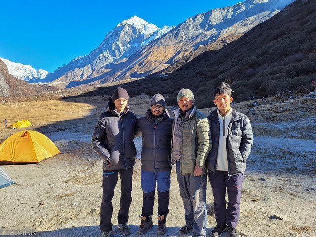
I hiked to Guicha La (also spelt as Goecha La, Goche La, etc), a high altitude pass in the eastern Himalaya near the south-eastern flank of Kanchenjunga, during late November 2022. This was a 6-day trek. The trekking party consisted of 3 members, including a Guide.
We booked the trek through Hotel Himsagar. This was a so-called dry trek i.e. we carried our hiking/camping gear but not food. We bought food from the caretakers of the Trekkers Huts at the campsites along the way. The trek organizer provided the Guide and trailhead accomodation and also took care of the paperwork required for trekking within the national park.
A less strenuous (although costlier) alternative is to book a full-service trek wherein the organizer provides a guide, camping gear, food, staff and pack animals, and all one has to do is walk to the next campsite each day carrying a daypack.
Day 0 (21 Nov 2022): Siliguri - Yuksom
We hired a car (arranged via the trek organizer) for the 140 km drive from the plains of Siliguri to the trailhead at Yuksom (elevation 5,800 feet), West Sikkim. We started from Siliguri at 08:23 and reached Yuksom at 14:00. To give you an idea of the lay of the land, here's a map I drew after one of my previous treks to that region -

After checking into the hotel and lunch at one of the nearby restaurants, we hiked to the nearby Coronation Throne site and Dubdi Monastery.
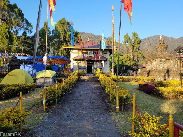
In the evening, we met our Guide, Pranit who took photocopies of our ID cards and photos for submitting to the police checkpost.


I had been monitoring the weather forecast for this region for the past few days and good weather was forecast for the duration of the trek - the forecast was accurate for a change and it was bright and sunny all through except for half a day of fog on Day 2. Nothing beats deep blue skies in the crisp mountain air.
Day 1 (22 Nov 2022): Yuksom - Tshoka
Yuksom (5,800') to Tshoka (9,800'), 16 km
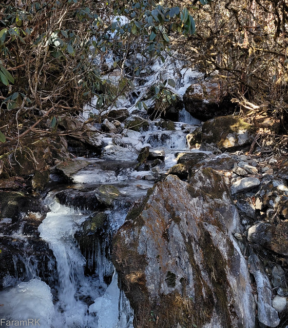
We had breakfast at the hotel and started off at 08:10. As the trek is through Kanchenjunga National Park (KNP), the first port of call was the KNP checkpost where the guide wrapped up the paperwork for getting permits to enter the NP. After that, we soon left Yuksom behind and onto a well-traversed forest trail. This trail has quite a bit of human and animal traffic with trekking parties going to and fro, as also long trains of pack animals (dzos and ponies) supplying the various campsites and the HMI basecamp at Chaurikhang. We reached the first suspension bridge over a stream and the entrance gate of KNP at 09:27, a bit over an hour after departing the KNP checkpost at Yuksom.
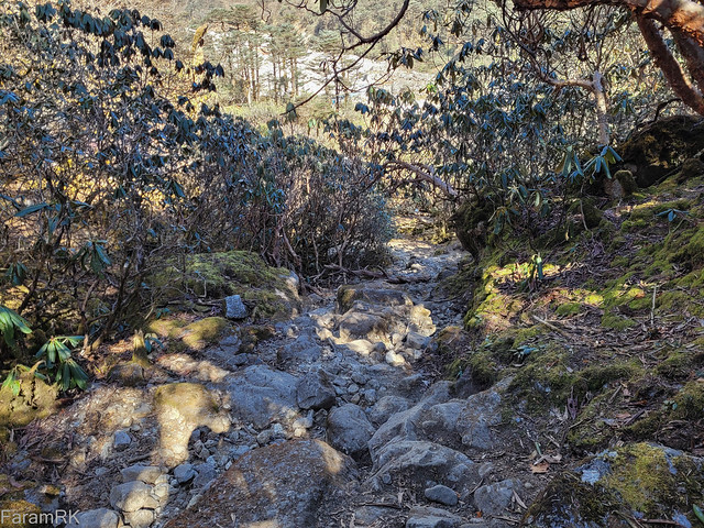
The trail passed through deciduous forest, with the hillside on the right and the Rathong Chu river, sometimes seen, far below on the left. It was an almost straight traverse of the hillside right upto the confluence of the Rathong Chu and Prek Chu rivers at 7,400 feet elevation. This part of the trail did have up and down bits but very few (short) switchbacks that were mostly in place to workaround landslides across the trail. With clockwork precision, we passed the next two bridges at hourly intervals.
We reached the first campsite, Sachen, at 11:45 after 10 km of hiking. Some groups halt here for the day but our itinerary was to head up to Tshoka. We took a 45 minutes break and ate the packed lunch provided by our hotel. Then it was back on the trail and more of the same hillside traverse with some ups and downs until a short, steep descent to Prek Chu bridge (elevation 7,400 feet), which we reached at 13:25. We took a 10 minute break before starting the climb to Bakhim.

The next leg was a 2.5 km painful, continuous climb to Bakhim (elevation 8,600 feet). We took a 30 minute tea and snacks break to recoup then continued the climb to Tshoka for another 1.5 km. We arrived at Tshoka (elevation 9,800 feet) at 16:15, half an hour before sunset. It was a bracing 4 ℃ with clear skies. We found a spot to pitch our tents and set up camp for the night.
We had dinner at 19:00. A couple of ladies from Yuksom had set up shop under an awning near the Trekkers Hut where they served hot meals to anyone that cared to buy. We had the standard rice, dal, veggies meal. It was now 0 ℃ outside the tent and 5 ℃ inside.
Day 2 (23 Nov 2022): Tshoka - Dzongri
Tshoka (9,800') to Dzongri (13,000'), 6 km
I got up at 05:30 to a foggy, overcast 3 ℃ day. The cloud and fog had moved in overnight, so although it kept the night relatively warm, it made for a dreary and damp start to the day. After morning ablutions and breakfast, we started the second leg of the trek at 08:36. It began with a 3 km steep climb (with a short, flat section midway) to Phedang (elevation 12,000 feet). The trail passed through forests containing conifers and rhododendron shrubs.

We reached foggy Phedang at 11:10 and halted for an hour to rest and recoup. We broke out the packed lunch (rice and omelette) along with a couple of mugs of hot tea. Phedang has a solitary hut with a caretaker who sells tea and snacks and although it's on a nice, flat section of the ridge, people don't usually camp here as the water source is quite a way below the ridge. The trail forks at Phedang - the one on the right heading to Kokchurung and the one on the left heading up to Dzongri. We headed up the latter.
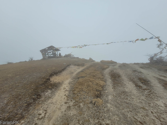
Next, it was a 1 km, 1.5 hour steep climb to Deorali (elevation 13,200 feet). This place is above the treeline and there's a small shrine to mark the place. It was foggy and windy this time around, but when I had been here on a previous trek, it was bright and sunny with panoramic views of the Himalayan peaks.
The hardest bit of today's hike was now done. The remainder was a 2 km walk along the rolling ridgeline and I arrived at Dzongri (elevation 13,000 feet) by 14:20. By now the clouds and fog had dissipated and it was bright and sunny.
The reason for this relatively short hike today was because of the rapid increase in elevation of 3,000 feet between campsites. To minimize the risk of AMS (Acute Mountain Sickness), for non-acclimatized persons, when travelling to elevations of 10,000 feet and higher, it is recommended to restrict increase in sleeping elevation over consecutive days such that the average doesn't exceed 1,000 feet per day. As we would be sleeping at the same elevation for the next 2 days (i.e. 3 days at 13,000 feet) , it was ok to make this relatively large jump in sleeping elevation from Tshoka to Dzongri (although it wasn't ok for one of my trek mates during a previous trek).
Dzongri is nestled within a 3-sided hollow on a ridge that stretches from Tshoka in the south to Kabru in the north, and thence to Kanchenjunga. We pitched our tents in the lee of the Trekkers Huts in order to be shielded from the wind funnelling into the hollow, in case it picked up during the night (which it didn't).
None of the toilets at this campsite were operational. Anyway, our Guide went above and beyond his brief and made one of the toilets functional again - don't ask me how :)
We had dinner (rice, dal, veggies, omelette) at the caretaker's cottage then it was time for some shuteye, as I had an increasing headache since I reached Dzongri. It was minus 2.5 ℃ outside the tent and 5 ℃ warmer inside.
Day 3 (24 Nov 2022): Dzongri - Thansing
Dzongri (13,000') to Dzongri Top (13,500') return, 1.7 km
Dzongri (13,000') to Thansing (13,000') , 6 km
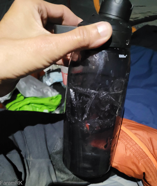
The plan for the day was to get up early to catch the sunrise over the Himalayan peaks from Dzongri Top, a small prominence on the ridge, 500 feet higher than the campsite. I woke up at 04:15. It was minus 7 ℃ outside the tent and my water bottle had frozen inside the tent.
But the good news was that the stars were shining bright, so we should be getting a good view of the forthcoming sunrise. We started the hike to the top at 05:15 - we didn't want to get there too early and huddle around in the freezing cold wind, waiting for the show to start. It was a 35 minute hike to the top and the view was well worth the effort, with the golden sunlight gliding over each peak of that grand amphitheatre in turn.

After taking in the view, we headed back to the campsite at 06:15. After breakfast (rice, omelette) at the caretaker's cottage, we struck camp and headed towards Thansing at 09:30.

We climbed up and out of the hollow then the trail meandered along the nearly flat ridgeline for 3.5 km. Pandim (elevation 21,952 feet) dominated the skyline from hereon. We would be hiking to its base tomorrow to reach the furtherest point of the trek.

Next, it was a steep 1,000 feet descent on slippery scree down to the Prek Chu river at Kokchurung (elevation 12,000 feet). I was painfully slow on this section due to my aching joints, and it took me an hour to get through this section.
Kokchurung consists of a single uninhabited Trekkers Hut and a small campground. After taking a short break, we resumed the hike by crossing the fast flowing Prek Chu to its eastern bank.

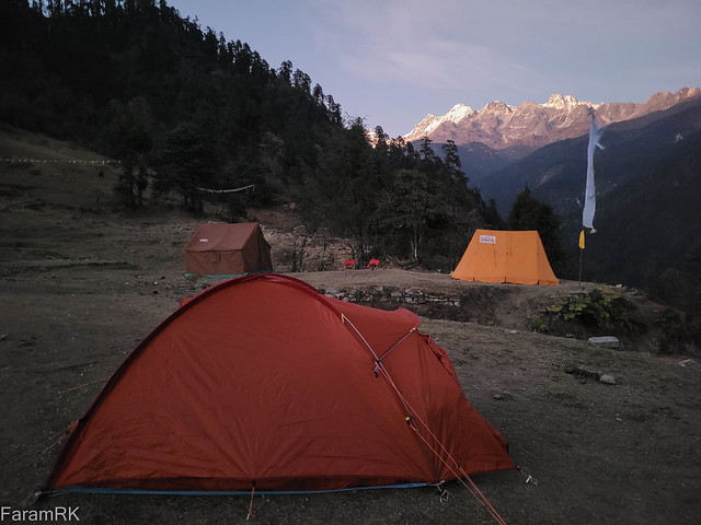
There were small, rickety wooden bridges placed strategically over sections of the river, without which it might have been almost impossible to cross the roiling, cold torrent. Then we started the final climb of the day to regain the 1,000 feet of lost altitude through a talus field to Thansing. We reached Thansing (elevation 13,000 feet) at 15:15. It's located at the mouth of a relatively wide and gently sloping valley of the upper Prek Chu.

At any campsite, I always make it a point to find the perfect spot to pitch my tent. So after wasting time and energy scouting for suitable spots in that vast campground, I finally found the perfect spot. On moving in, the first thing I find is that the damn floor is tilted in both pitch and roll ! I was too knackered to bother finding another spot and setting up house all over again, so I just packed unused stuff from my backpack under the pad, to prevent falling off the pad onto the cold floor during the night. Next, it was time for an early dinner and some long exposure night shots, then off to sleep, in preparation for the walk to the pass the next day.
On the topic of low-light photography, here's one taken with the phone camera https://flic.kr/p/2o4MR4a and here's another one taken at almost the same spot with a full-frame DSLR during a previous trek - https://flic.kr/p/AW27JC. The difference in image quality is stark, but it's not discernible when viewed on tiny mobile device screens.
Day 4 (25 Nov 2022): Thansing - Guicha La Viewpoint 1 return
Thansing (13,000') to VP1 (15,000') return, 13 km
Although the trek is named Guicha La trek, the Forest Dept no longer allows trekkers to hike to the pass proper - instead they need to turn back from some arbitrary point called Viewpoint 1 (VP1) which is 4 km short of, and a bit over 1,000 feet lower than the pass.
Most trekking parties start at some unearthly hour, very early in the day, in order to witness the sunrise from VP1. We had our fill of a super sunrise the previous day from Dzongri Top so started from Thansing at a more respectable 05:15. It was minus 3 ℃ with clear skies. We didn't strike camp so our backpacks were very lightly loaded with essentials for the day trip.
Unfortunately, there was a bit of a hiccup right after leaving camp. I lost my balance over one of the slippery stepping stones while crossing the first of innumerable shallow streams across our path. My boots instantly filled up with icy cold water which gave me quite a shock. I waddled over to a dry patch and quickly removed my soaked socks in the light of my headlamp and took out a pair of waterproof socks from my backpack and put them on. The soaked socks quickly froze stiff in the cold air. In fact, I had brought along these waterproof socks especially for this section of the trail considering the large number of stream crossings, but I didn't put them on when leaving camp - lesson learnt! After this pathetic display of my sense of balance, our long-suffering guide helped me across most of the remaining water crossings 🤦
Although dawn had broken, it kept getting colder (down to minus 8 ℃ ) as we gradually climbed up the valley. The strong gusts of freezing cold katabatic winds moving down the valley added to the chill and I had to put on my down jacket as the heat generated by hiking wasn't enough to prevent the body from cooling. 4 km into the hike, we reached Lamuney (elevation 13,700 feet) at 07:00.

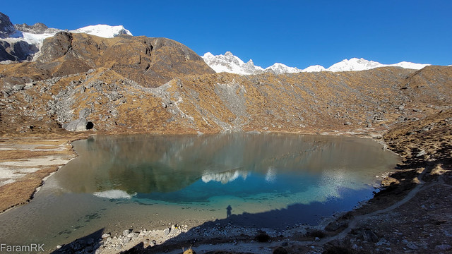
This uninhabited campsite consisted of a forlorn kitchen hut. We took a 15 minute break here sheltering from the wind. The guide also replenished our water bottles from the Prek Chu flowing nearby. Another 2 km and 1 hour 15 minutes later brought us to Sungmotong Cho aka Samiti Lake (elevation 14,200 feet). It was a beautiful sight with its crystal clear shallow waters. Even at this high altitude, there was a bird wading in the centre of the lake.
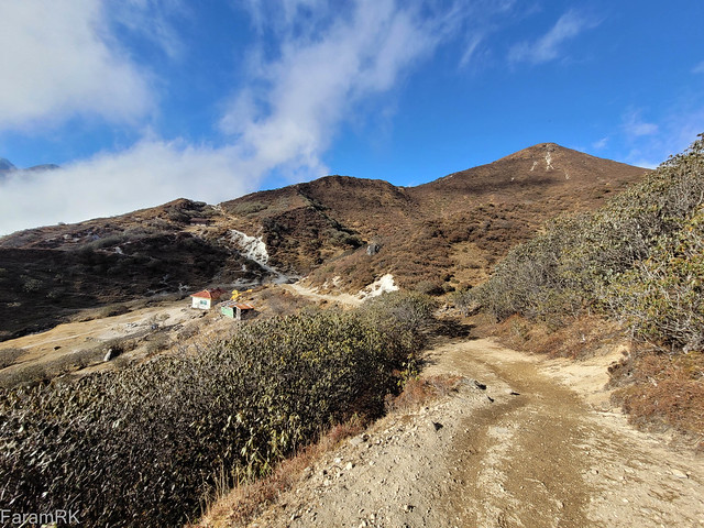
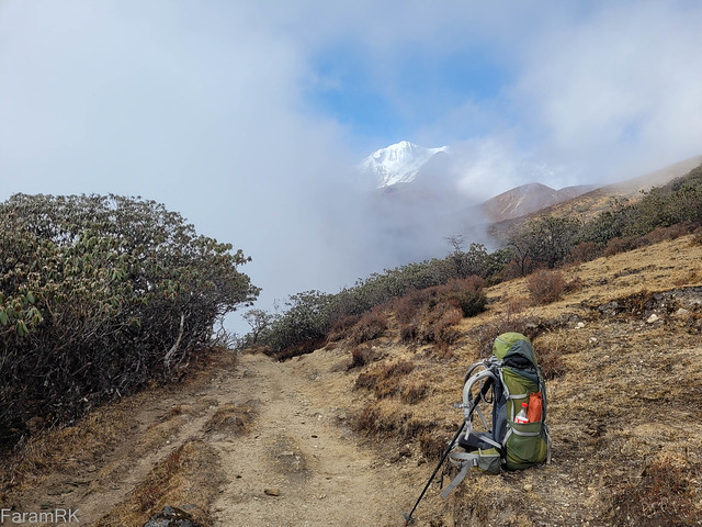
It was now getting increasingly difficult to breathe due to the low atmospheric pressure at this altitude and we had to take frequent short breaks to catch our breath. But the final kick in the butt was saved for the last - it was a steep ascent of 800 feet elevation gain on a lateral moraine of Onglakthang glacier to Viewpoint 1 (elevation 15,000 feet). The spot was marked by prayer flags. It was located on the western flank of Pandim, directly across from the intersection of Onglakthang glacier and another glacier originating from Forked Peak.
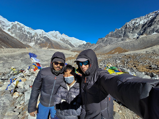
One couldn't have asked for better weather or visibility to hike to the highest point of the trek - the air was cold with a freezing wind while at the same time the sunlight was burning hot, under the deep blue sky. One could see Guicha La in the distance in the north behind which was the massive south-eastern flank of Kanchenjunga. We were surrounded by these famous Himalayan giants - the Kabru peaks, Forked Peak, Kanchenjunga, Pandim, etc. We arrived at 10:00 and stayed for 45 minutes before heading back. The plan wasn't to stay for so long, but time flew - maybe due to our oxygen-deficient befuddled brains :)
We headed back the way we had come. Although going down wasn't as hard on the cardio system, the steeper bits were hard on my joints. Also, I was feeling the symptoms of mild AMS. To top it all, I had only had some biscuits and a couple of energy gels since starting from camp in the morning, as the kitchen didn't open until after we left. We had banked on buying a few Coke bottles from the Trekkers Hut to fuel our climb, but they didn't have any left in stock.
We arrived back in Thansing campsite at 14:45. I had some ORS, tea and omelette then crashed in my tent - the very thought and smell of lunch caused me to want to puke, so I gave it a miss.
Day 5 (26 Nov 2022): Thansing - Tshoka
Thansing (13,000') to Tshoka (9,800') , 13 km
After breakfast (egg fried rice) in the caretaker's smoky kitchen, it was time to head back home. We departed Thansing at 08:20 and retraced our path down the talus field to the Prek Chu ford thence to Kokchurung on the other bank of the river.

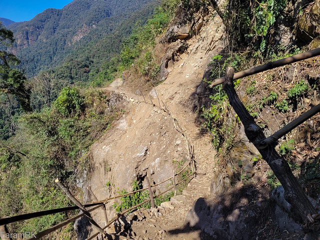
We reached Kokchurung 09:30 and after a short break, proceeded on the trail forking towards the left direct to Phedang, bypassing Dzongri. It was a long traverse of the hillside with ups and downs but no net change in altitude. The trail was mainly through shady deciduous forest with lots of gnarly, mossy trunks and branches. Most of the streams along the trail had frozen over.
There was a section of trail with a fresh, unstable landslide with barely enough room to cross over. The guide helped us cross that bit. We reached Phedang 13:30 and stopped for brunch (omelette, tea, biscuits). This time around it was bright and sunny at Phedang. Next was the descent to Tshoka. We arrived at Tshoka at 16:20, half an hour before sunset.
We decided to hire a cabin in the Trekkers Hut rather than pitch our tents. The mattresses on the beds were rock hard so I slept on my inflatable pad placed over the so-called mattress. There seemed to be some sort of noisy party going on in the adjacent cabin with periodic yelling by the whole lot along with banging on the walls....it was going to be a long night 🤦
Day 6 (27 Nov 2022): Tshoka - Yuksom
Tshoka (9,800') to Yuksom (5,800') , 17 km
The original plan was to hike to Yuksom and stay overnight there then drive down to Siliguri the next day. But last night we decided to reach Siliguri in a single day. There was patchy mobile phone reception in Tshoka so we were able to convey our change of plan to the trek organizer and he helped arrange a car to take us to Siliguri on the same day that we reached Yuksom.
After tea and biscuits, we departed Tshoka at 06:23 and retraced our steps down to Yuksom via Bakhim and Sachen.
We reached our hotel in Yuksom at 13:27 and had lunch. We departed Yuksom at 14:02 in the hire car. There was a change of car at Gerethang then it was a long drive to Siliguri, arriving at 20:20, in time for dinner.
Gear
I carried all my stuff in my trusty old Deuter ACT-lite 65 litre backpack. All up, it weighed a bit over 16 kg (including 1 litre water and 750 ml Coke). You can find the full packing list here - https://lighterpack.com/r/iy1g3l
The tent I used was a Decathlon MT100 2-person dome tent. This was my first outing with this tent. At 2.5 kg, this tent is on the heavier side, but it's a well-constructed solid tent.
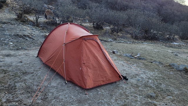
Its an outer-first pitch tent so it's well suited for pitching in rainy conditions. The inner material is fabric except for mesh on half the door - so it retains heat well and is not drafty. It's easy to maintain a taut pitch and the fly and inner are well separated so I never had any issues with condensation. The tent is very roomy for a single occupant and gear (in fact I wouldn't mind a slightly smaller and lighter tent). The vestibule is big enough and with enough headroom to keep muddy boots and such and to put on/off rain gear while protected from the rain. I prefer a side-opening door and vestibule as its easier to get in and out, but this end-on door/vestibule design worked just fine. I used a home-made groundsheet - a plastic mattress protector, cut to size. This kept the outside of the tent floor relatively clean - quite useful in animal dung infested campsites :)
For clothing, I wore a merino wool top and softshell pants while hiking. At the higher, colder elevations I added merino tights under the pants. For insulation, I wore a light synthetic puffy jacket at the lower camps and also when I felt cold while hiking. At the higher camps, I used a bigger down jacket instead of the synth one. The down jacket was also used for parts of the final push to the pass. For the feet I wore wool socks and mid hiking boots. I prefer mid boots over trail running shoes as it better secures my feet on long, steep descents and prevents my toes getting squashed at the front.
My sleep system was a 0 ℃ (comfort rating) down sleeping bag over an R 2.7 inflatable pad. This kept me toasty warm with just a base layer at lower camps but at the higher, colder camps I wore my down jacket inside the sleeping bag, for additional warmth. I also lightly draped my rain gear over the foot of my bag to keep the toes warm. The final addition for the higher camps was placing a mylar sheet (emergency blanket) under the pad to reflect back up the heat radiated from my body - this final bit might just have been a placebo effect instead of actual prevention of heat loss :)
I used a single hiking pole for added push on steep climbs and for taking pressure off the joints on descents. It was also helpful for balance on slippery rocks across streams.
I used a smartphone for photography/videography. It definitely isn't in the league of a full-frame DSLR, especially in low-light, but it got the job done at ⅒th the weight of a full-frame setup. I also used the smartphone as a journal to record the trek.
I used a GPS watch for logging the trek (including health metrics) and kept all the electronics charged using a 20,000 mAh powerbank.
Final Thoughts
The observations recorded in this post are from the point of view of a reasonably fit middle-aged man, afflicted by rheumatoid arthritis for the past many years. So what I find painful and/or tiring might be walk in the park for someone fitter with all body parts in good order - as amply demonstrated by our Guide time and again :)
This is not a difficult trek, but the fitter you are, the better it is - just take it easy and Enjoy 🥳
Links
Strava activities related to this trek -
Video of this trek -
Photo album of this trek - https://flic.kr/s/aHBqjAis81
No comments:
Post a Comment