
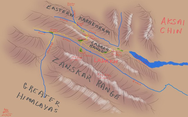
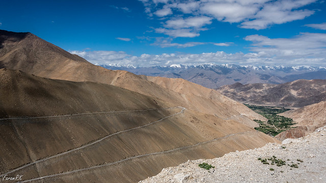
The Himalayas running north west to south east form the southern bounday of Ladakh. It also includes the Zanskar Range, which is a branch of the Himalayas. North of the Zanskar Range is a wide valley through which runs the Indus river. It flows from the south east to the north west. Parallel to the Indus and to its north is an offshoot of the Karakorum Range, called the Ladakh Range. North of the Ladakh Range, and parallel to the Indus is the river Shyok. North of the Shyok and running north west to south east is the Eastern Karakorum Range. As can be seen, most of the prominent geographical features are aligned along a north-west south-east axis.
The Himalayas cuts off Ladakh from the rest of the Indian sub-continent, hence its geography and much of its people and culture are more akin to Tibet and Central Asia than the plains of India. To add to the world's store of trivia, a quick check on Google Earth reveals that the distance (roughly 2,800 KM) from Leh (the capital of Ladakh) to Ulaan Bator, Mongolia is the same as that from Leh to Kanyakumari, the southern tip of India !
Ladakh is a large area and not having too many days in hand, I was only able to visit a few places in central and eastern Ladakh.
Getting There
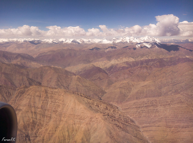
I flew into Leh, the capital of Ladakh, on a morning flight from Delhi. The flying time was 1' 03". It's a very scenic flight as one flies across the Himalayas. There's a very stark difference in scenery from the brown and green patchwork of the plains to the ice-capped Himalayas, thence to the barren brown and white scenery of Ladakh.
A description of the approach into Leh Airport (VILH), and departure a few days later, is the subject of another post.
Day 1 - Leh
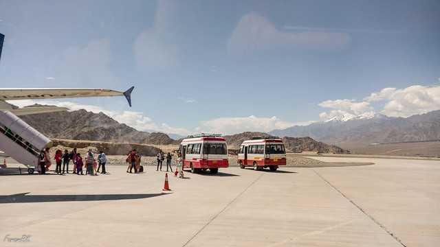
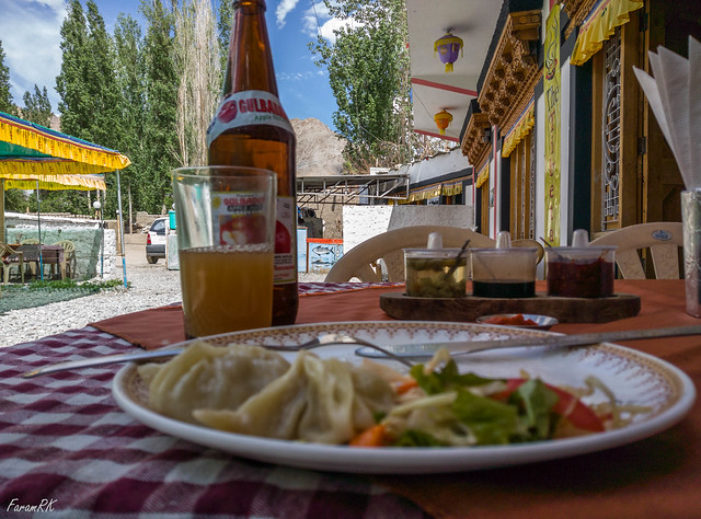
Landing at Leh Airport around 10:00, I hopped into a taxi for a short drive to my guest house in Leh town. Mutup, the driver asked me if I had any sightseeing plans and mentioned in passing that he was an ex-serviceman from Ladakh Scouts. That was a good enough recommendation for me, and it was agreed that he would take me around to see the sights, during my short stay in Ladakh.
The weather was warm, a comfortable 27 °C, though it was hot under the burning sun at high altitude.
This being summer, I didn't need to wear any layers over my shirt most of the time. This was a refreshing change from the hot muggy weather in the plains, before the onset of the monsoon.
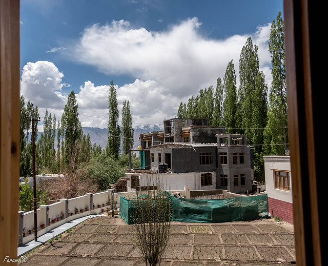
On reaching the guesthouse, there was a minor hiccup of sorts when I had to wait for nearly an hour because the previous occupants hadn't yet vacated the upstairs special 'room with a view', as one of them was quite unwell. On finally occupying the room, I sensed quite a strong smell of vomit in the air. I assumed that's just how Ladakhi bedsheets smelt :) but on further investigation found that the smell was emanating from the bathroom. The hard-working housekeeping staff scrubbed and disinfected the bathroom a few times and that tell-tale whiff almost but never quite disappeared. But that was a minor irritant, and all in all I had a very pleasant and comfortable stay there.
After resting in my room for a couple of hours, I took a leisurely walk around town. Due to Leh's high altitude (elevation 11,500'), it is advisable to take it slow in order to let the body acclimatize to the rarefied air. Though I felt alright at rest, climbing even a few steps or walking a gentle up slope, caused breathlessness. Getting too excited and rushing about to get on with the holiday might jeopardize the holiday itself.
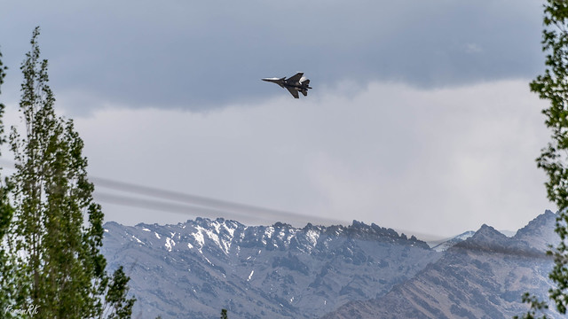
After lunch, I headed back to my room and was treated to some IAF Su-30 jets whizzing by my window.
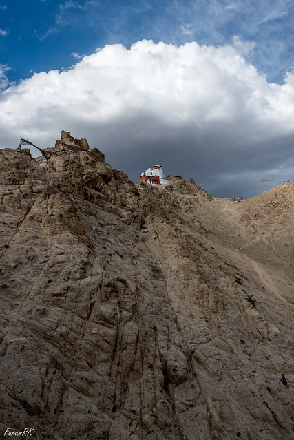
Later we drove up to Leh Palace, which is located at the end of a ridge overlooking Leh town.
Next up on the itinerary was Tsemo Gompa located further up the same ridge.
This was followed by a visit to Shanti Stupa, located on a hillock near the north-west edge of town.
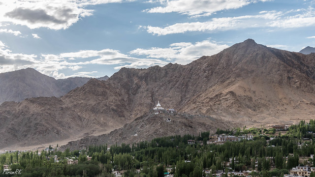
It was nightfall by the time I got back. I had developed a lingering headache due to climbing up and down all those stairs.
Here's a video of the entire day -
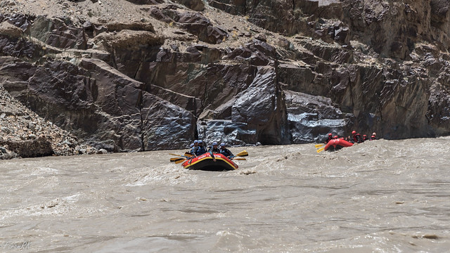
We also drove a few kilometers up the Zanskar where some rafting was going on. The water was fast flowing, muddy and cold to the touch.
We headed back towards Leh, in time for lunch.
Here's a video of the entire day -
Day 2 - Indus - Zanskar Sangam and Stok
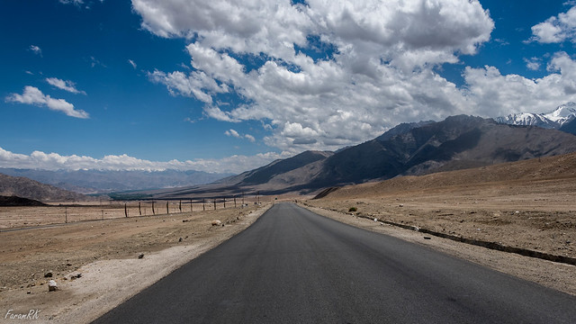
Day 2 got off to a glorious start with clear blue skies and a pleasant 20 °C. It was designed with an easy start at 10:00. Before arriving in Ladakh, I had planned my itinerary in a 'scientific' way :) i.e. taking it easy and at relatively low altitudes during the initial days and progressively higher altitudes on succeeding days.
Indus - Zanskar Sangam
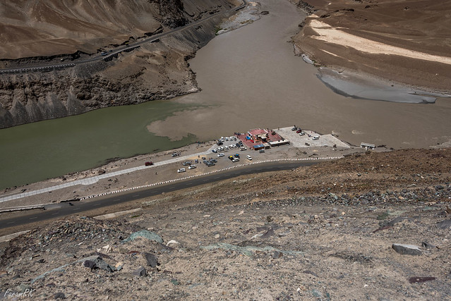
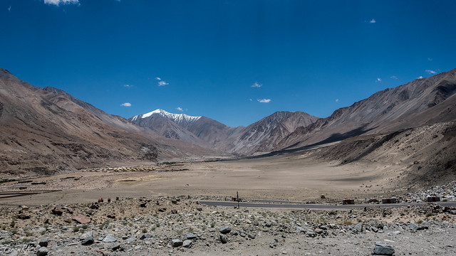
First up was a drive to Sangam i.e. the confluence of the Indus and Zanskar rivers, which is near Nimmu, 35 KM west of Leh. The elevation, at 10,300', is lower than Leh. There is a distinct difference between the placid greenish Indus and the fast flowing muddy Zanskar.
We headed back towards Leh, in time for lunch.
Here's a video of the Sangam trip -
Stok is well known for being the starting point of the Stok Kangri trek. Stok Kangri (20,182') is the highest peak in the part of the Zanskar range visible from Leh.
Here is a video of the Stok trip -
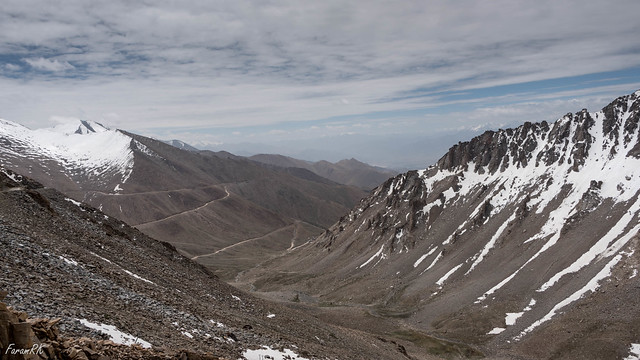
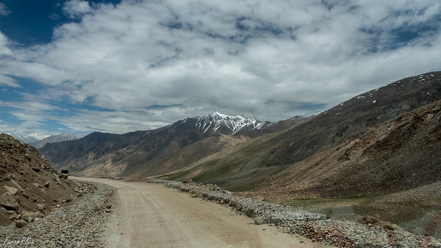
The road condition is fair until the checkpost at South Pullu, after which it rapidly deteriorates and is in really bad shape on either side of the pass. The air was full of expletives as one's head banged the roof for the umpteenth time !
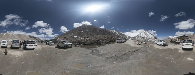
There is a veritable carnival at the pass with tourist vehicles jammed end to end with diesel fumes in the air. Here's a shot from the pass. The photographer couldn't find any spot without some vehicle or the other intruding into the frame !
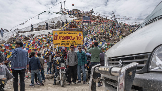
Khardung La pass (elevation 17,582') is used to cross the Ladakh Range between the Indus and Shyok valleys. Please disregard the elevation marked on the sign board. In 1856 A.D, more than a century before the era of all prevalent computers and GPS, without even having access to the mountain, the Survey of India measured the height of Mount Everest and were off by just 27 feet. And now in 2016 we have this sign board showing an elevation that's in error by nearly 800 feet. I think it really indicates the height of the peak at the eastern end of the saddle and not that of the pass itself...
The oxygen available at this altitude is a bit over half that at sea level, hence, it's not advisable to stay here for too long unless well acclimatized. From the pass, the road winds down to North Pullu, Khardung, Rong and Khalsar, getting better all the time.
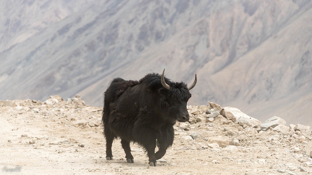
One might also bump into a yak (or dzo) wandering on the road...lest we forget, he is the original inhabitant of this land:)
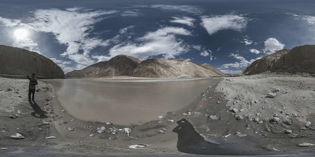
Finally , the road meets the Shyok river at the Trimod bridge (elevation 10,400') where one way leads across the river to the Nubra valley. The Shyok water temperature didn't feel as cold as the Zanskar. Click and drag on the image below to view the 360X180 panorama.
The plan was to head to the Nubra valley, but we had to return from the bridge because we were well past the turn around time to head back to Leh. So we headed back up the road we had come. Here's Khardung village as seen from the north -
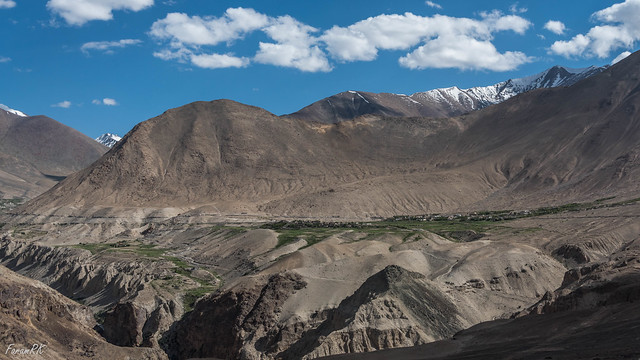
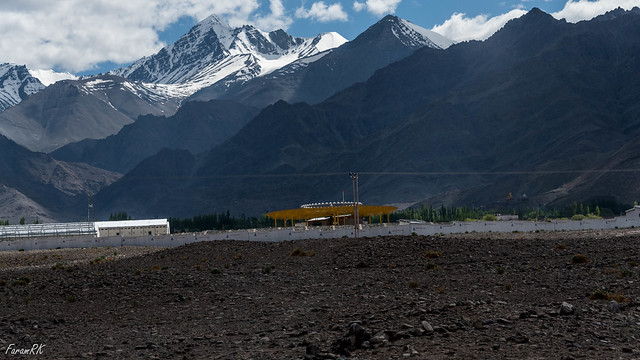
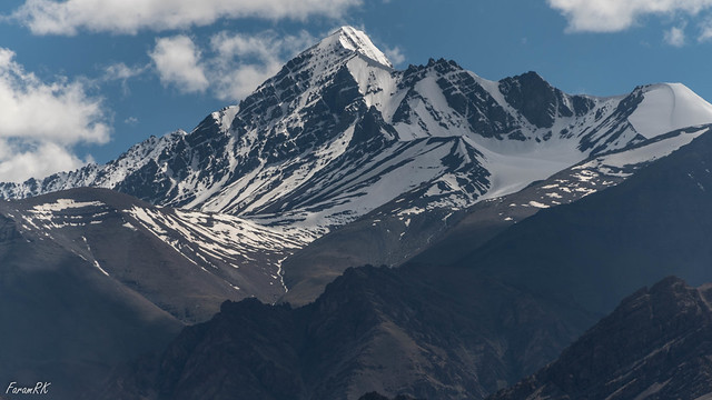
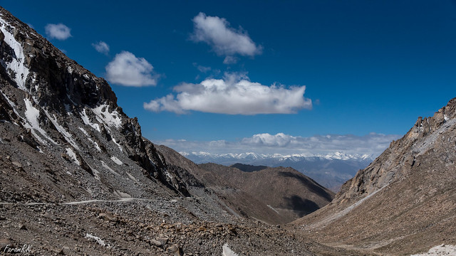
All over central and eastern Ladakh, the dominant colours are brown and white, along with dabs of bright green wherever there is human habitation. The reason for the barrenness is that the high Himalayan mountains to the south don't allow the moisture laden monsoon winds to cross over into Ladakh.
As the road steadily climbs up the Ladakh Range, one gets to see Khardung La from the north.
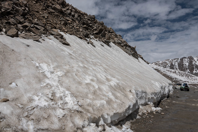
5 KM short of the pass, at 16,600' our vehicle got stranded in a snow melt stream flowing across the road-with-no-surface. This stream was benign on the way down earlier in the day, but now with a full day's worth of heating and melting by the sun, it's flow had increased a lot. I got out to push the vehicle, and though the fast flowing very cold water was not even calf deep, within a minute, my feet were numb and it was impossible to remain in the water any longer. Finally, after 35 minutes of pushing and manoeuvering by helpful drivers and bikers, we were able to get the vehicle unstuck.
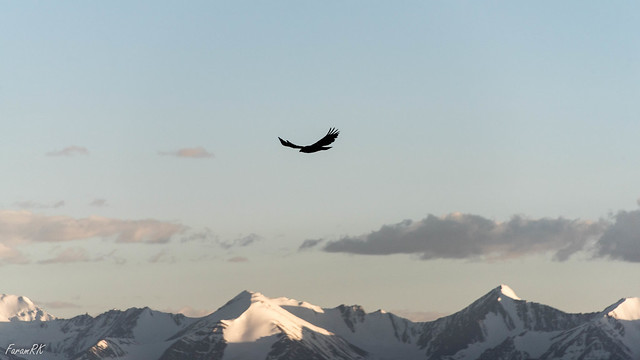
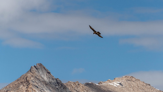
After all that excitement, the way down to Leh was uneventful. I spotted a Golden Eagle soaring near the pass.
Here's a video of the day trip -
And a few minutes later I spotted a Lammergeier soaring near the road, over the body of a marmot roadkill.
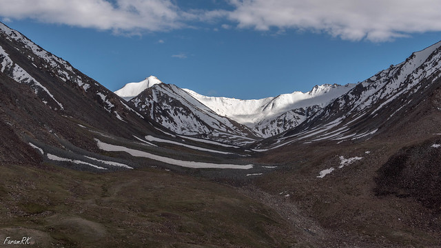
As per the usual protocol, the vistas kept getting grander and the road progressively worse as one neared the pass.
Although Chang La (elevation 17,590') is as high as Khardung La, it's not been given the 'Highest motorable road in the world' moniker, though I did spot one 'World's highest restaurant' sign board !
After Chang La, the road winds down to Tsoltak, near which were two ponds, one of which was still frozen since the last winter.
The road then turns south east and passes through a wide valley between Durbuk and Tsangtse. This is the lowest point after Chang La, at 12,800'. I also spotted a flat area abeam the dogleg on approaching Durbuk, that would make a perfect Gliding airstrip. I could visualize an aircraft on base over the road, then turning left (SSE) on to final and landing on the proposed 'World's highest gliding airfield' !
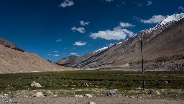
From Tangtse, there is a gentle rise all the way to Pangong Lake. Though most of this section is barren, there are beautiful meadows in and around Muglib, with grazing yaks/dzos, sheep and horses.
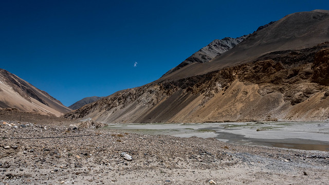
While nearing the lake, the valley floor fills up with fine white sand and white (maybe salt) deposits which seems like the bottom of some defunct river or lake.
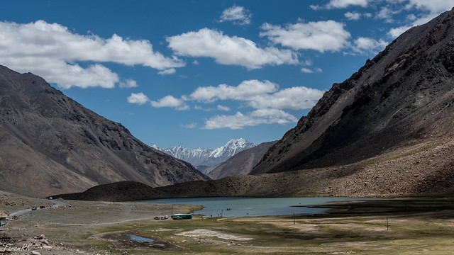
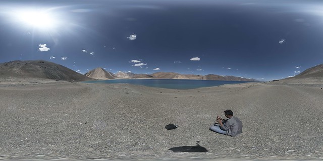
Finally we arrive at the western end of Pangong Lake (elevation 14,270'). It is a long lake that enters Aksai Chin towards the east. It's a magnificent sight with the multi hued blue-green calm waters of the lake surrounded by barren hills and snow capped peaks, under a deep blue sky. Click and drag on the image below to view the 360X180 panorama.
The water was crystal clear, cold and brackish. I dunked my head under the surface to cool off from the piercing sunlight at high altitude. Though cooling, it's not advisable to do so because the slightly salty water stung my eyes and sunburnt parts of my face. Relaxing at the lake beach, one felt like being at any other beach at sea level, except for the breathlessness on climbing even the slightest of grades.
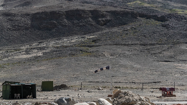
After a quick lunch at one of the crowded lakeside shacks/restaurants, we headed back towards Leh by the same road we had come on. On the way back, the evening valley wind picked up near Durbuk, as shown by a helipad windsock in the image below.
While nearing Chang La on the way back, at around 16,500', the vehicle I was travelling in (a Maruti Van) stalled and I had to get out and walk for a bit while the driver rolled the vehicle downhill for a bit, revved up to max power and staggered back up the road-with-no-surface. Other than that minor incident, no dramas. At Zingral (elevation 15,553'), we found a group of bikers trying to inflate a tyre with a hand pump (and lots of sweat & patience). Mutup wanted to show off his shiny new tiny electric pump, so we stopped and it inflated the tyre within a few minutes !
Here's a video of the day trip -
Time
Place
Altitude
Distance (KM)
10:00
Leh
11,500’
0
11:10
Indus-Zanskar Sangam
10,200’
33
12:00
Zanskar rafting point
10,300’
41
13:15
Leh
11,500’
81
Time
|
Place
|
Altitude
|
Distance (KM)
|
10:00
|
Leh
|
11,500’
|
0
|
11:10
|
Indus-Zanskar Sangam
|
10,200’
|
33
|
12:00
|
Zanskar rafting point
|
10,300’
|
41
|
13:15
|
Leh
|
11,500’
|
81
|
Stok
After lunch, we headed towards Stok village (elevation 11,473'). This village is 15 KM south of Leh on the opposite bank of the Indus. Approaching Stok, one comes across Leh VOR (LLH), which was also visible from the flight into Leh.
Here is a video of the Stok trip -
Time
Place
Altitude
Distance (KM)
14:45
Leh
11,500’
0
15:30
Stok Kangri trek starting point
11,795’
15
15:40
Heading back
14:30
Leh
11,500’
30
Time
|
Place
|
Altitude
|
Distance (KM)
|
14:45
|
Leh
|
11,500’
|
0
|
15:30
|
Stok Kangri trek starting point
|
11,795’
|
15
|
15:40
|
Heading back
| ||
14:30
|
Leh
|
11,500’
|
30
|
Day 3 - Shyok Valley via Khardung La
Day 3 started off cloudy and temperature 18 °C. We started off at 08:00 towards the Shyok river valley via the famous Khardung La pass. The drive winds up north from Leh, traversing the Ladakh Range.
There is a veritable carnival at the pass with tourist vehicles jammed end to end with diesel fumes in the air. Here's a shot from the pass. The photographer couldn't find any spot without some vehicle or the other intruding into the frame !
Khardung La pass (elevation 17,582') is used to cross the Ladakh Range between the Indus and Shyok valleys. Please disregard the elevation marked on the sign board. In 1856 A.D, more than a century before the era of all prevalent computers and GPS, without even having access to the mountain, the Survey of India measured the height of Mount Everest and were off by just 27 feet. And now in 2016 we have this sign board showing an elevation that's in error by nearly 800 feet. I think it really indicates the height of the peak at the eastern end of the saddle and not that of the pass itself...
The oxygen available at this altitude is a bit over half that at sea level, hence, it's not advisable to stay here for too long unless well acclimatized. From the pass, the road winds down to North Pullu, Khardung, Rong and Khalsar, getting better all the time.
One might also bump into a yak (or dzo) wandering on the road...lest we forget, he is the original inhabitant of this land:)
Finally , the road meets the Shyok river at the Trimod bridge (elevation 10,400') where one way leads across the river to the Nubra valley. The Shyok water temperature didn't feel as cold as the Zanskar. Click and drag on the image below to view the 360X180 panorama.
The plan was to head to the Nubra valley, but we had to return from the bridge because we were well past the turn around time to head back to Leh. So we headed back up the road we had come. Here's Khardung village as seen from the north -
All over central and eastern Ladakh, the dominant colours are brown and white, along with dabs of bright green wherever there is human habitation. The reason for the barrenness is that the high Himalayan mountains to the south don't allow the moisture laden monsoon winds to cross over into Ladakh.
As the road steadily climbs up the Ladakh Range, one gets to see Khardung La from the north.
5 KM short of the pass, at 16,600' our vehicle got stranded in a snow melt stream flowing across the road-with-no-surface. This stream was benign on the way down earlier in the day, but now with a full day's worth of heating and melting by the sun, it's flow had increased a lot. I got out to push the vehicle, and though the fast flowing very cold water was not even calf deep, within a minute, my feet were numb and it was impossible to remain in the water any longer. Finally, after 35 minutes of pushing and manoeuvering by helpful drivers and bikers, we were able to get the vehicle unstuck.
After all that excitement, the way down to Leh was uneventful. I spotted a Golden Eagle soaring near the pass.
Here's a video of the day trip -
Time
Place
Altitude
Distance (KM)
08:05
Leh
11,500’
0
09:40
South Pullu
15,255’
21
11:00
Khardung La
17,582’
36
11:30
Depart Khardung La
12:50
North Pullu
15,248’
49
13:25
Khardung
13,025’
63
14:40
Abeam Khalsar
10,817’
82
14:55
Trimod Bridge, Shyok
10,350’
88
15:25
Abeam Khalsar
10,817’
94
16:20
Khardung
13,025’
113
16:55
North Pullu
15,248’
127
18:45
Khardung La
17,582’
141
19:50
South Pullu
15,255’
154
20:40
Leh
11,500’
172
Time
|
Place
|
Altitude
|
Distance (KM)
|
08:05
|
Leh
|
11,500’
|
0
|
09:40
|
South Pullu
|
15,255’
|
21
|
11:00
|
Khardung La
|
17,582’
|
36
|
11:30
|
Depart Khardung La
| ||
12:50
|
North Pullu
|
15,248’
|
49
|
13:25
|
Khardung
|
13,025’
|
63
|
14:40
|
Abeam Khalsar
|
10,817’
|
82
|
14:55
|
Trimod Bridge, Shyok
|
10,350’
|
88
|
15:25
|
Abeam Khalsar
|
10,817’
|
94
|
16:20
|
Khardung
|
13,025’
|
113
|
16:55
|
North Pullu
|
15,248’
|
127
|
18:45
|
Khardung La
|
17,582’
|
141
|
19:50
|
South Pullu
|
15,255’
|
154
|
20:40
|
Leh
|
11,500’
|
172
|
Day 4 - Pangong Lake via Chang La
The temperature was a pleasant 17 °C at 06:00. We started off an hour later, heading south-east on the Leh-Manali highway. At Karu, we turned left to head north east towards Chang La.
After Chemrey, the road started winding up, in order to cross the Ladakh Range at Chang La.
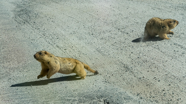
After passing Zingral, we were lucky to spot a couple of cute and furry Golden Marmots frolicking in the middle of the road.
After Chemrey, the road started winding up, in order to cross the Ladakh Range at Chang La.
After passing Zingral, we were lucky to spot a couple of cute and furry Golden Marmots frolicking in the middle of the road.
And a few minutes later I spotted a Lammergeier soaring near the road, over the body of a marmot roadkill.
As per the usual protocol, the vistas kept getting grander and the road progressively worse as one neared the pass.
Although Chang La (elevation 17,590') is as high as Khardung La, it's not been given the 'Highest motorable road in the world' moniker, though I did spot one 'World's highest restaurant' sign board !
After Chang La, the road winds down to Tsoltak, near which were two ponds, one of which was still frozen since the last winter.
The road then turns south east and passes through a wide valley between Durbuk and Tsangtse. This is the lowest point after Chang La, at 12,800'. I also spotted a flat area abeam the dogleg on approaching Durbuk, that would make a perfect Gliding airstrip. I could visualize an aircraft on base over the road, then turning left (SSE) on to final and landing on the proposed 'World's highest gliding airfield' !
From Tangtse, there is a gentle rise all the way to Pangong Lake. Though most of this section is barren, there are beautiful meadows in and around Muglib, with grazing yaks/dzos, sheep and horses.
While nearing the lake, the valley floor fills up with fine white sand and white (maybe salt) deposits which seems like the bottom of some defunct river or lake.
Finally we arrive at the western end of Pangong Lake (elevation 14,270'). It is a long lake that enters Aksai Chin towards the east. It's a magnificent sight with the multi hued blue-green calm waters of the lake surrounded by barren hills and snow capped peaks, under a deep blue sky. Click and drag on the image below to view the 360X180 panorama.
The water was crystal clear, cold and brackish. I dunked my head under the surface to cool off from the piercing sunlight at high altitude. Though cooling, it's not advisable to do so because the slightly salty water stung my eyes and sunburnt parts of my face. Relaxing at the lake beach, one felt like being at any other beach at sea level, except for the breathlessness on climbing even the slightest of grades.
After a quick lunch at one of the crowded lakeside shacks/restaurants, we headed back towards Leh by the same road we had come on. On the way back, the evening valley wind picked up near Durbuk, as shown by a helipad windsock in the image below.
While nearing Chang La on the way back, at around 16,500', the vehicle I was travelling in (a Maruti Van) stalled and I had to get out and walk for a bit while the driver rolled the vehicle downhill for a bit, revved up to max power and staggered back up the road-with-no-surface. Other than that minor incident, no dramas. At Zingral (elevation 15,553'), we found a group of bikers trying to inflate a tyre with a hand pump (and lots of sweat & patience). Mutup wanted to show off his shiny new tiny electric pump, so we stopped and it inflated the tyre within a few minutes !
Here's a video of the day trip -
Time
|
Place
|
Altitude
|
Distance (KM)
|
07:10
|
Leh
|
11,500’
|
0
|
08:20
|
Karu
|
11,050’
|
34
|
09:23
|
Zingral
|
15,553’
|
60
|
10:08
|
Chang La
|
17,590’
|
72
|
10:25
|
Depart Chang La
| ||
10:55
|
Tsoltak
|
16,500’
|
78
|
11:50
|
Durbuk
|
12,795’
|
99
|
12:10
|
Tangtse
|
12,903’
|
106
|
12:40
|
Muglib
|
13,474’
|
120
|
13:28
|
Pangong Lake
|
14,270’
|
138
|
14:55
|
Depart Pangong Lake
| ||
15:40
|
Muglib
|
13,474’
|
158
|
16:15
|
Tangtse
|
12,903’
|
173
|
16:25
|
Durbuk
|
12,795’
|
180
|
17:27
|
Tsoltak
|
16,500’
|
200
|
18:05
|
Chang La
|
17,590’
|
207
|
18:40
|
Zingral
|
15,553’
|
216
|
19:47
|
Karu
|
11,050’
|
241
|
20:45
|
Leh
|
11,500’
|
273
|
Day 5 - Departure
I got on the morning flight back to Delhi. On landing, it was hot and muggy with droves of people going everywhere and nowhere. My Ladakh sojourn was definitely over !
Odds & Ends
Physiology
As I was flying into Leh, a high altitude region, from sea level, and had limited time to acclimatize, I started a course of Diamox (125 mg x2 daily), 24 hours before arriving in Leh. I also needed to take aspirin on a couple of days to get rid of lingering headaches.
I carried an oximeter with me. The readings are summarized below.
Place
|
SpO2
|
Pulse
|
Leh (11,500’)
|
82 - 94%
|
64 - 90 bpm
|
High Passes (17,600’)
|
70 - 72%
|
90 - 92 bpm
|
High Passes - Mutup
|
80 - 84%
|
77 - 78 bpm
|
I discovered that I could temporarily increase the SpO2 value to 98% at Leh by taking 17 deep breaths and to 90 - 91% at the high passes by taking 20 - 30 deep breaths.
Due to the Sun's high UV radiation at high altitude, one must cover up fully and wear a wide brim hat. I was a bit careless and hence had to suffer sunburn and painful blisters. The lips also get chapped, so applying lip balm is a good idea.
Due to the Sun's high UV radiation at high altitude, one must cover up fully and wear a wide brim hat. I was a bit careless and hence had to suffer sunburn and painful blisters. The lips also get chapped, so applying lip balm is a good idea.
Telecommunications
Only post-paid SIM cards from outside the state work in Ladakh. On top of that only BSNL and Airtel service providers seem to work. My BSNL SIM worked but my Vodafone SIM never worked (even though it was post-paid along with roaming facility). Data connectivity only worked once for a few minutes, at pathetic dial-up speeds. For the widest phone coverage in Ladakh, BSNL seems to be the best bet.
No comments:
Post a Comment